Recently, a group of six of us here had the opportunity to make an amazing pilgrimage.
We took a trek across the southern mountain range of Haiti, descending back down to sea level at the coast. The hike is well traveled by Haitians, yet only a few courageous outsiders (or uninformed outsiders, like us!) have truly endeavored this trek.
—
BEEP BEEP BEEP…. BEEP BEEP BEEP… It’s 5am. The day we begin a hike that Beth McHoul described as life changing. I didn’t think we would ever have the time or opportunity to travel this infamous hike. As with the story of our lives in Haiti, there were bits and pieces of information we knew, yet we didn’t understand the full story.
This was our plan:
Travel on a 2 day journey, in the third-world country of Haiti, beginning in the mountains at the city of Furcy. Hike day 1 on a trail we don’t where begins. Sleep the night in the middle Haiti’s national forest at the house of an unknown location. Finally, wake up and contiue to the finish of the hike towards an unmarked city. What could go wrong!?
Before leaving, I pulled out our suitcase scale to test how much my backpack weighed with the 3L camel pack of water. I contemplated packing jeans but quickly realized they alone weighed almost 2 lbs. Soon I was scaling down my items to the bare necessities. With 6 people in our group, we tried minimizing unneeded or duplicate items. Eventually, I ended up with a 15 pound pack.
Today I am excited, we are hiking the outback of Haiti! Melissa made smoothies for breakfast and, as scheduled, our driver pulls up at 5:30am. We head for Furcy, Haiti from the Heartline Guest House in Tabarre.
BANG!
Just after passing Péttionville, we see water exploding from the hood of the vehicle! This can’t be good! I just laughed. I was just thinking how amazing it was the driver had actually picked us up at the requested time. Mel and I have only hired a driver on one other occasion and it was to bring us up to the lodge in Furcy. On that trip, the tire blew too, and it was around a 2-3 hour fix since we were already in the mountains. On this occasion, self-designated mechanics turn up, ready to help!

It takes about 1 hour and we are off again towards Furcy!
We got a tip from some friends on Facebook we should veer left after reaching the barn with the giant “Furcy” painted on it. Forging ahead past that, the road is very rocky. We signal to our driver to stop here. Now begins the pilgrimage across the mountains.
The first steps are always the easiest. The sights are incredible. We start to pass a small village where people are making “fritay” (a Creole word for, “fried”). I shout out, Anyone want some pate? We stop by the stand and buy a newly fried pate for everyone. We get 3 for around 60 cents. A great snack for the beginning of the hike. As we walk further we see other small clusters of people cooking and selling food.


The beginning of our journey had started at 3,000 ft. above sea level, but the trail quickly ascended to 5,000 ft. The terrain steadily rising, while at the same time undulating in 500 ft. intervals up and down.
In a land of “mountains beyond mountains”, the picture below portrays why we were in continual descent or ascent.

Almost noon, we reach a small village and buy more pate’s. This time the pate’s we buy have fish in the middle! Not good! I would advise others to avoid those at all necessary costs :-D.
Drinks are also available, but surprisingly we haven’t found water packets available, as are ubiquitous in Port-au Prince. This isn’t a problem for us though, as we have each brought plenty of water for the journey.
Below is a picture of this small village.


We reach the first heavily wooded area, called La Visite National Park, almost 5 hours from the beginning of our hike. This place provides great shelter from the sun, but we were fortunate that the sun has been hidden all day anyways as we walked through fog and clouds.
Make no mistake, this is not your regular nature trail. At this point we have been huffing and puffing through what was probably a 2 mile steady incline. As far as we can tell, we have currently reached a nice flat plateau.

We begin asking people we pass where Winnie’s house is located. I was beginning to think this place was a ghost house. Searching the location on the internet gives zero details on how to actually arrive at here. When trying to reach Winnie by phone, all the numbers posted online did not work, and the email message I sent was returned as invalid. Even the lonely planet travel guide was wrong. I finally replaced @hotmail.com with @gmail.com just to see if it was a mistake. Sure enough, that was how I finally got in contact with Winnie!
We reach a “Seguin” sign and find a man sitting on a rock just to the right of the sign. He points us toward the right turn to reach, “Kay Winnie.”

After going to the wrong house, we find Winnie’s house on the left a ways up the road. He has a bull mastiffs dogs and tents out in his yard for us to sleep in for the night. We were thankful for the hot tea served as soon as we arrive. Exhausted from the 6 hour journey, we crash for a short rest before dinner.


The tents have mattresses in them that are actually quite comfortable. Maybe we were too tired to notice any differently? He provided sleeping bags for us too. After the long day, we all crash for a much-deserved nap.
At dinner, we meet another couple who had made the journey but came in much later than us. They had heavier packs and had walked several miles further then us (having started back at the Rustik lodge). Some good laughs were shared as, together, we thought back over the memorable events from the day.
The meal was delicious and, being wiped, we all went straight to bed afterwards.
The next morning it is off to the races! After an excellent breakfast of eggs and toast with jam, we again hit the trail, this time with sore muscles.
It’s not soon after starting that we begin seeing an unusual landscape: grandiose white rocks eerily teetering up from out of the ground.


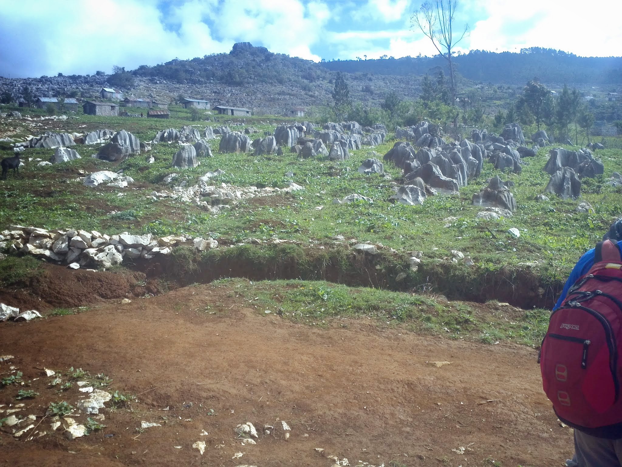
One website says, We were sitting in a field covered with limestone rock formations that have emerged here over the years because rains had washed away literally yards of the ridge’s topsoil. For centuries Haiti’s forests have been cut down to be turned into charcoal, still the primary cooking fuel for millions of Haitians.
With nearly no tree cover left to hold soil onto the mountainous terrain, the United Nations now estimates erosion is claiming 36 million tons of topsoil every year.
Well…
Speaking of rough rocks. The path is very unstable and rocky almost the full hike. You can usually veer to the left or right and find a more traveled route. So far the path has been descending since leaving Seguin.

We didn’t take the short-cut to the market from Kay Winnies, but after an hour on the main “road,” we arrive at the small village. Mangoes and all sorts of fruit are available for purchase. Since we just had breakfast, we’re not to hungry yet, and continue on.
What’s this? In the distance, we can hear something. We stop and listen closely. Oh no, is that ran hitting tin roofs? Yes, and it’s coming closer! We quicken our pace and begin looking for shelter. One tin house had an overhang – we quickly asking the young lady if we could take shelter there and she said yes. Sure enough, the rain came and poured down torrentially!


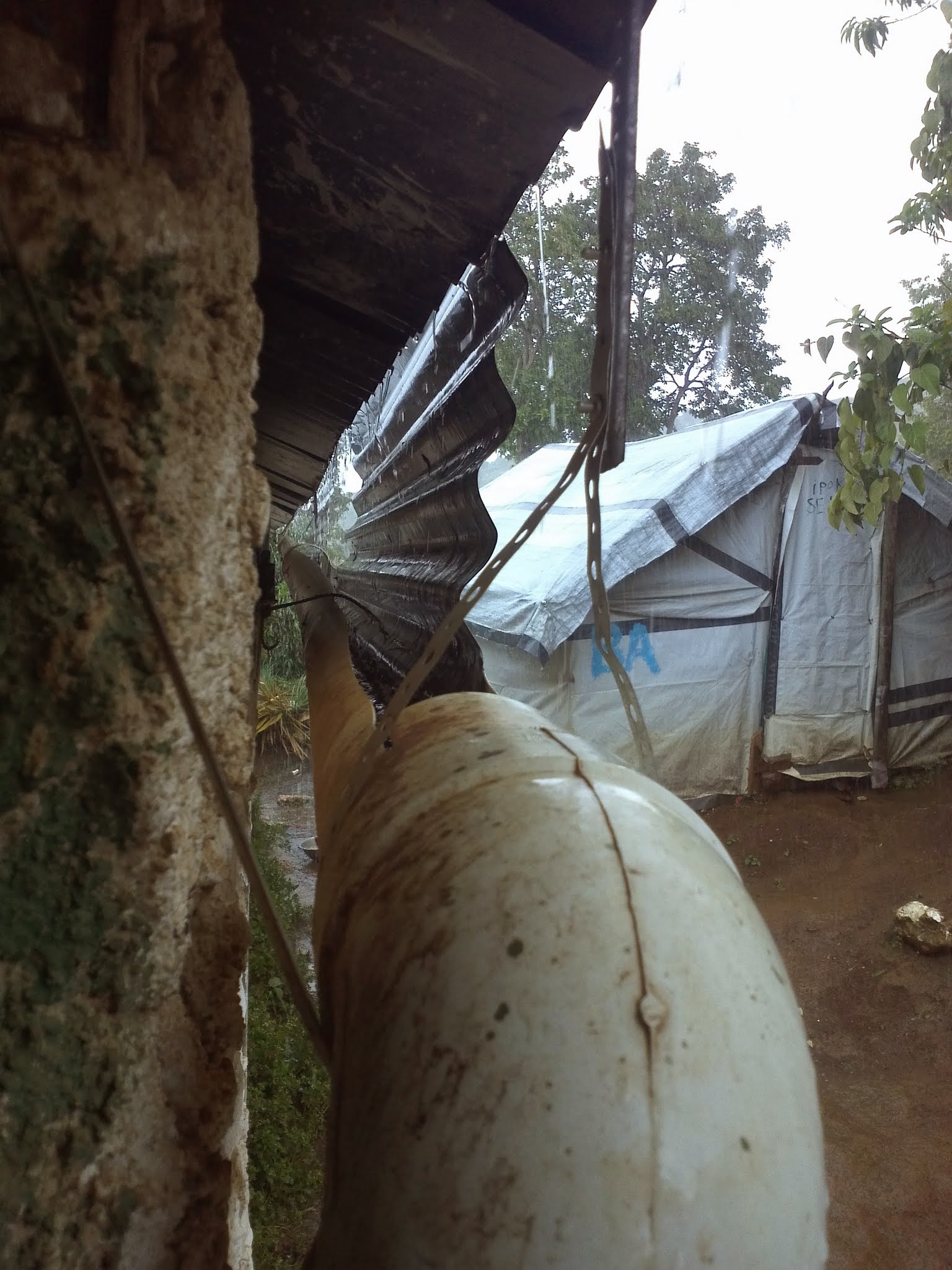
I was impressed because the houses had hooked up PVC pipe to the edge of the roof so that rainwater was funneled ran into a pipe and then in a bucket. As we were sitting under the shelter the lady filled up some 3-4 buckets of water that came off the roof. Talk about going green :-D.

After the rain ended… Onward and downward to the ocean! We could start to see the ocean. Locals told us it rains every afternoon there.

Hit a small stream cascading down rocks along the way. Not trying to mention how much our feet hurt by this point. It’s 3 pm and we have been on the road for about 6 hours.

The girls take a moto taxi at 4:15pm toward Jacmel. We find out later they had the ride of their life as it started to bucket down rain just after they got on. We end up huddling together under Nick’s poncho.

Again, once more the rain lets up – we keep on toward the goal!
Finally… Exhausted, we finish the hike in Perado at 6pm – 26 miles from our start point!

What we brought:
We had 6 people (one pack missing from the pic below). Each of us used school type packs or camelbak-type paks, focusing on keeping the weight down.
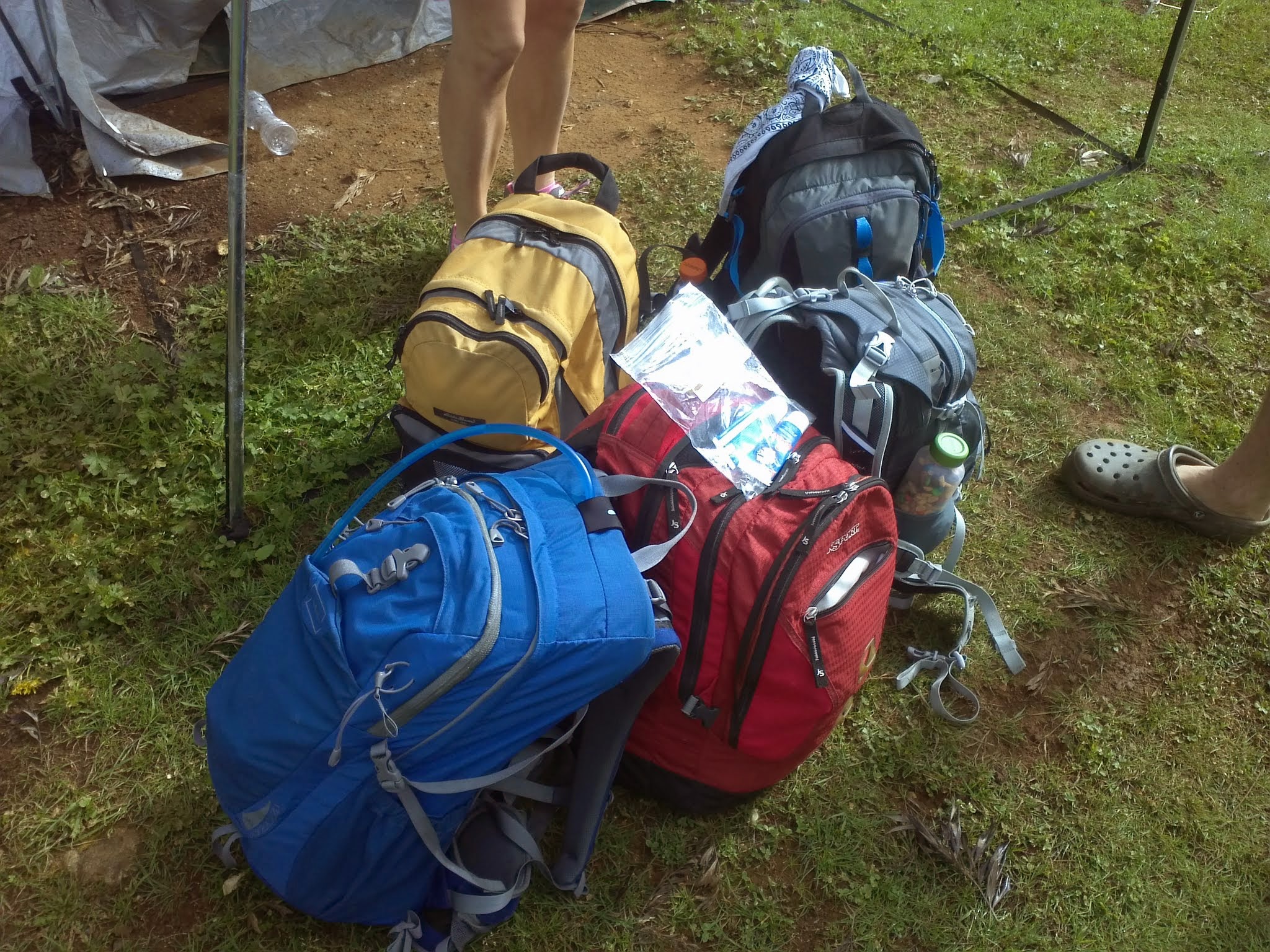
- 2-3L water
- 3 cups of trail mix
- 1 Sweatshirt
- 2 Shirts / 1 Short / 1 Swimsuit
- Flashlight (very small)
- Extra batteries for powering my phone (which had signal and GPS)
- First aid kit
- Knife (small)
- Sunscreen (30+)
Details for Winnie’s:
- winthropattie@gmail.com
- 3877-1556
- $40/person for 3 meals staying in a tent. $80/person for 3 meals staying in a room.
- Follow the Seguin sign and then you are almost there. The house will be located on the left less then a quarter of a mile up the road.
- 2 bathrooms with cold water showers on the property.
Details of the Hike
| Place | Height | Time | Picture | Comment |
|---|---|---|---|---|
| Start | 3,000 ft. | 9 am | 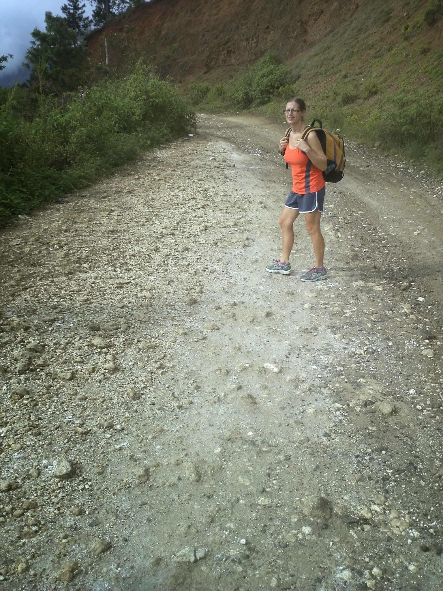 |
View map below to see marker location. |
| Alternate Start | 3,000 ft. | 9:30 am | 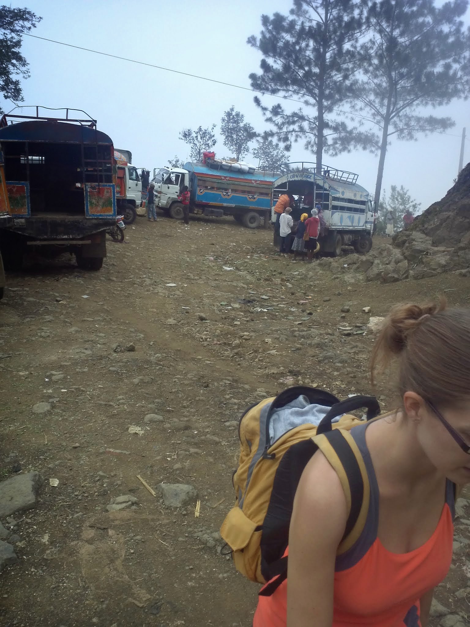 |
You will see large TapTap colored trucks. At this point a truck cannot go any further. |
| 2.5 mi. | 5,000 ft. | 10:20 am | |
|
| 5 mi. | 6,000 ft. | 11:37 am | |
|
| 8.3 mi. | 6,500 ft. | 2:42 pm | 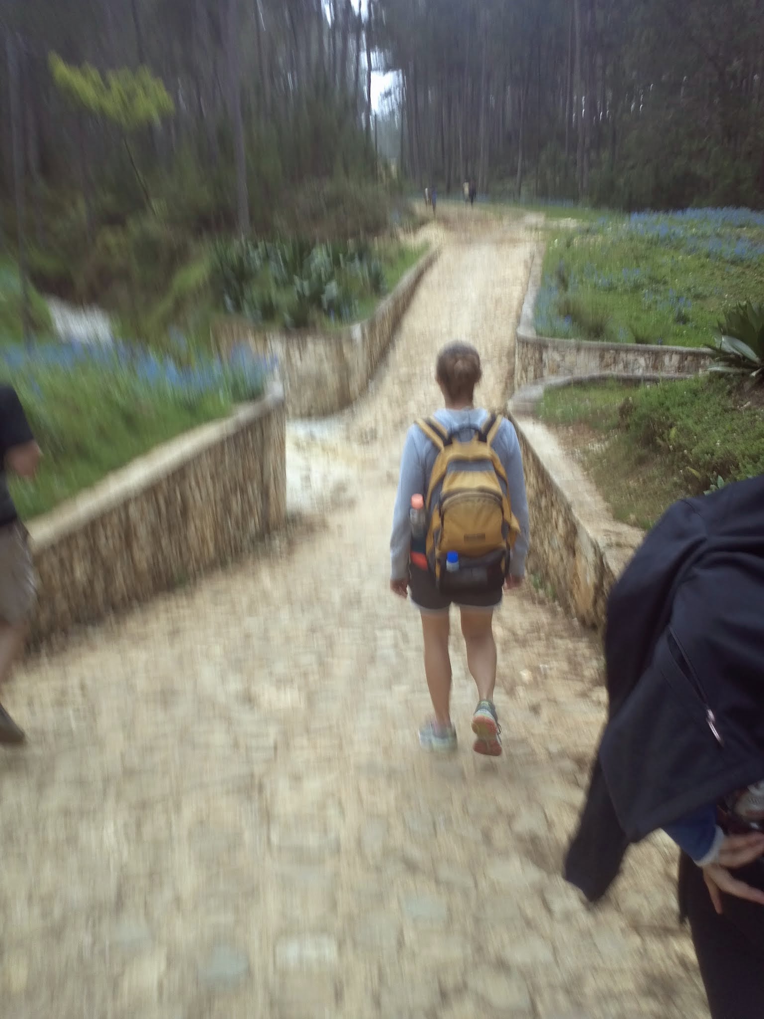 |
|
| 9.64 mi. | 6,000 ft. | 3:15 pm | 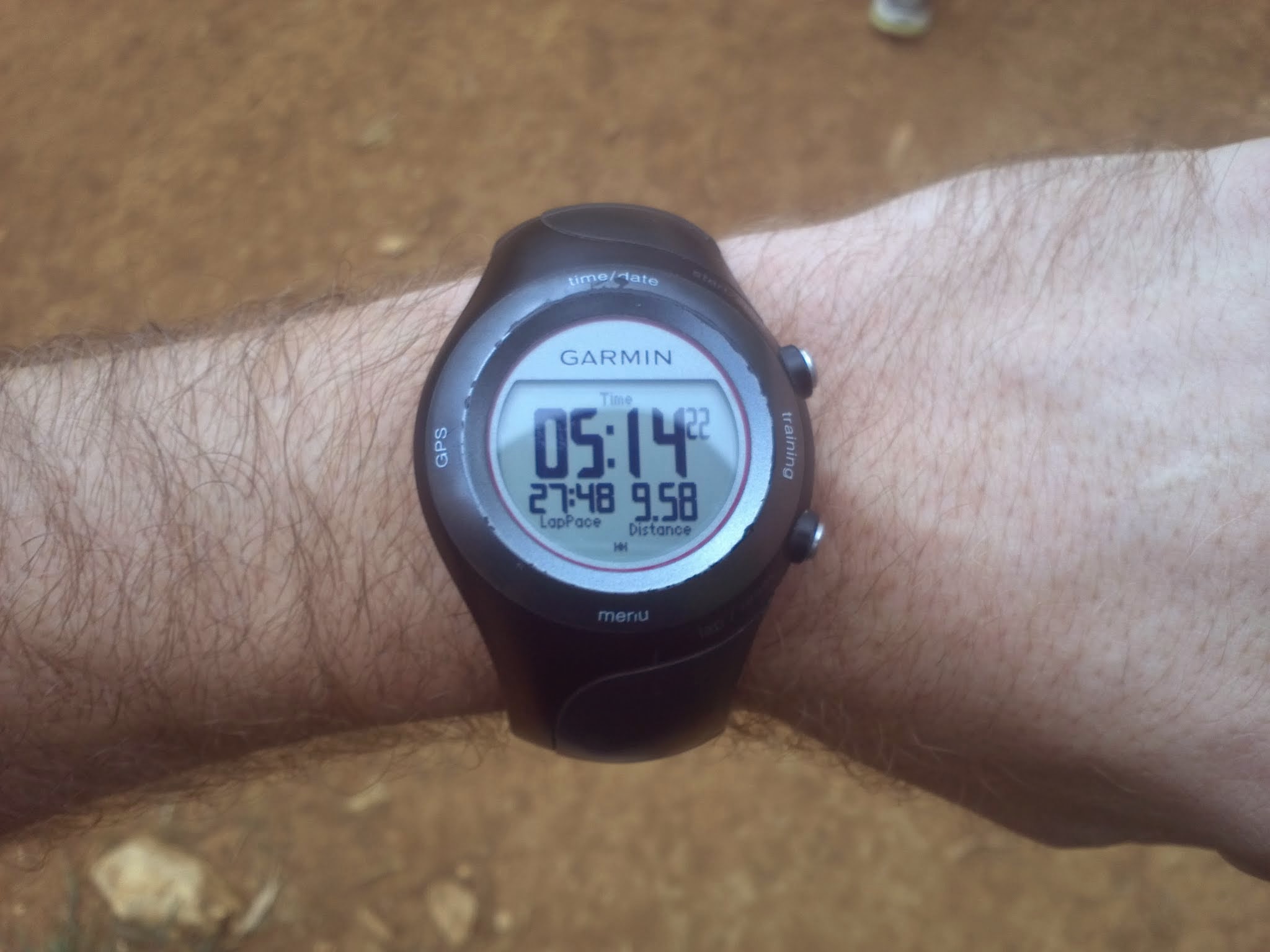 |
Rest at Winnie’s house. We paused the watch for breaks. Pic taken just before we arrived. 5hrs walking / 1hr rest. |
| Day 2 | Left the house at 9am. | |||
| 12.86 mi. | 5,000 ft. | 10:26 am | 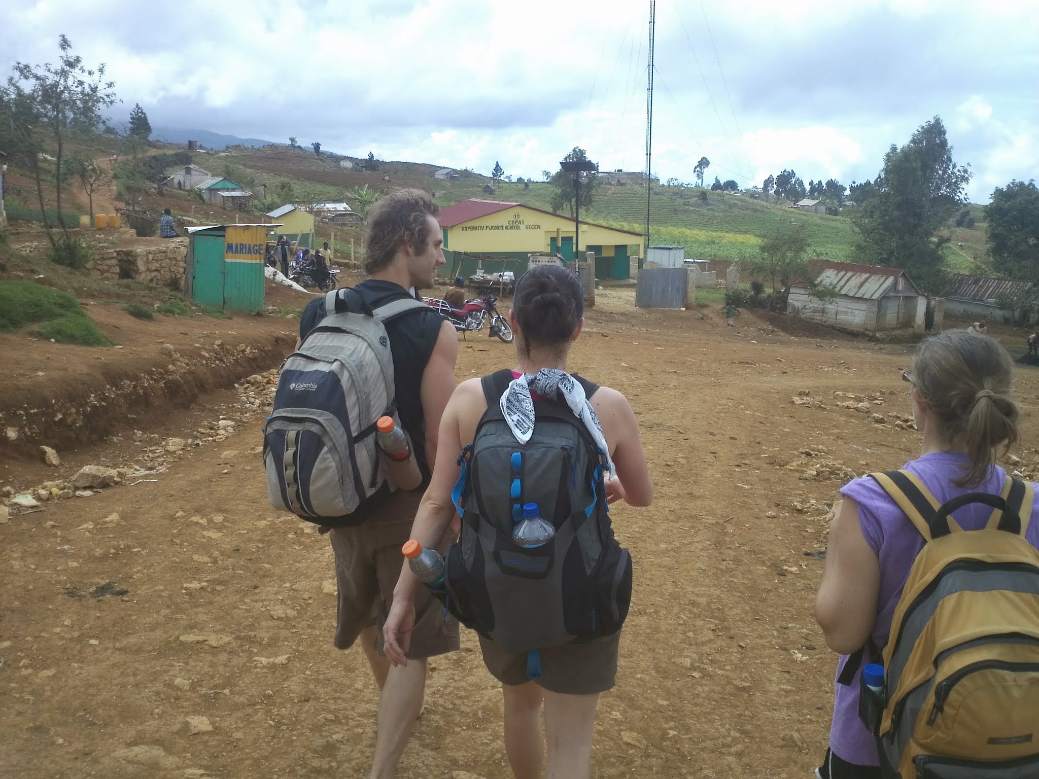 |
About 1 hour into the walk we reach the market. |
| 21 mi. | 2,600 ft. | 10:26 am | 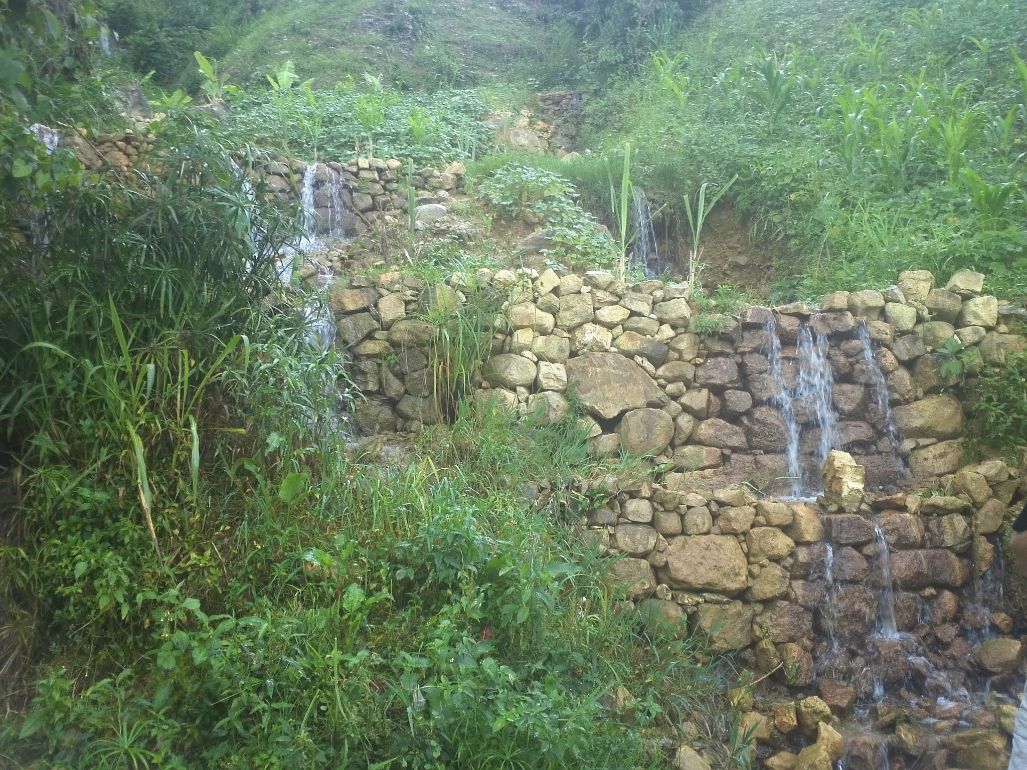 |
Small stream cascading down some rocks. |
| 23 mi. | 1,300 ft. | 4 pm | Moto’s available along this stretch if you feel like you won’t be able to make it on foot. | |
| 25.64 mi. | Sea level | 6 pm |  |
We landed in Perado. Finish! |
Google map of the key spots
Link to live map: https://mapsengine.google.com/map/u/0/edit?mid=z7jsZVTGeL_Y.kXCdRp9jCT5o

*Thanks to Nick for taking time to edit this post and add content.
11 responses to “Hiking the Mountains of Haiti from Furcy to Jacmel”
You guys are amazing. Can you still taste the fish pate?
Most of us can only imagine a trip such as the six of you experienced, or we view these majestic sites on the discovery channel. Despite the incredible physical challenge, I am so thankful that all of you were able to absorb yourselves in these indescribable landscapes. Ryan, thank you for sharing this adventure with all of us, providing yet another perspective of Haiti. It was great that Jen and Sam were able to join you in this trek!
Hi Ryan,
I am Roger from Haiti, I m so impressed by your history. I just start with my web site to promote Haiti and want invite more tourists to trek thtough the cool Mountains of Furcy. Would you mind if use pictires from you history to share people?
Please let me know, I also would like to stay in touch with you for your next visit to Haiti
My web page is in progress
Talk you soon
Roger
Nice write-up! I was lucky to bike the route first on MTB Ayiti, so when I walked it a few weeks later it was already familiar. Kudos for hiking it with limited information.
Ricky – that’s awesome you did the hike and ride! I am hoping that some of the info in this post will give courage to others to take the plunge with a bit more information! Haiti has some beautiful spots that would be great for tourism in the country. I had been living in Haiti for 2 years at this point and felt pretty comfortable. I looked again at this poist and realized some pics and maps were broken. I fixed those up! https://mapsengine.google.com/map/u/0/edit?mid=z7jsZVTGeL_Y.kXCdRp9jCT5o
Great to hear from you! I checked out your website – will you post pics of the trip?
Hi Ryan,
I am Roger from Haiti, I m so impressed by your history. I just start with my web site to promote Haiti and want invite more tourists to trek thtough the cool Mountains of Furcy. Would you mind if use pictires from you history to share people?
Please let me know, I also would like to stay in touch with you for your next visit to Haiti
My web page is in progress
Talk you soon
Roger
Thanks for sharing all the info about the hike. I’ve wanted to do that also, or a similar hike (thinking of going from Mirebelais to Montrois via mountain top). I really appreciate the map, packing info, etc. We live in Verrettes, in the Artibonite Valley. Mesi anpil.
Glad it was helpful!
Thanks for the detailed write-up!! I will doing this hike approx July 9-12, and your details are great!
So glad you found it useful!
It amazes me that the marche women, with children, walk this route from Jacmel to sell at the marche in Kenscoff